
Mittelpunkt: 2705632,1244517 - Radius: 500 m
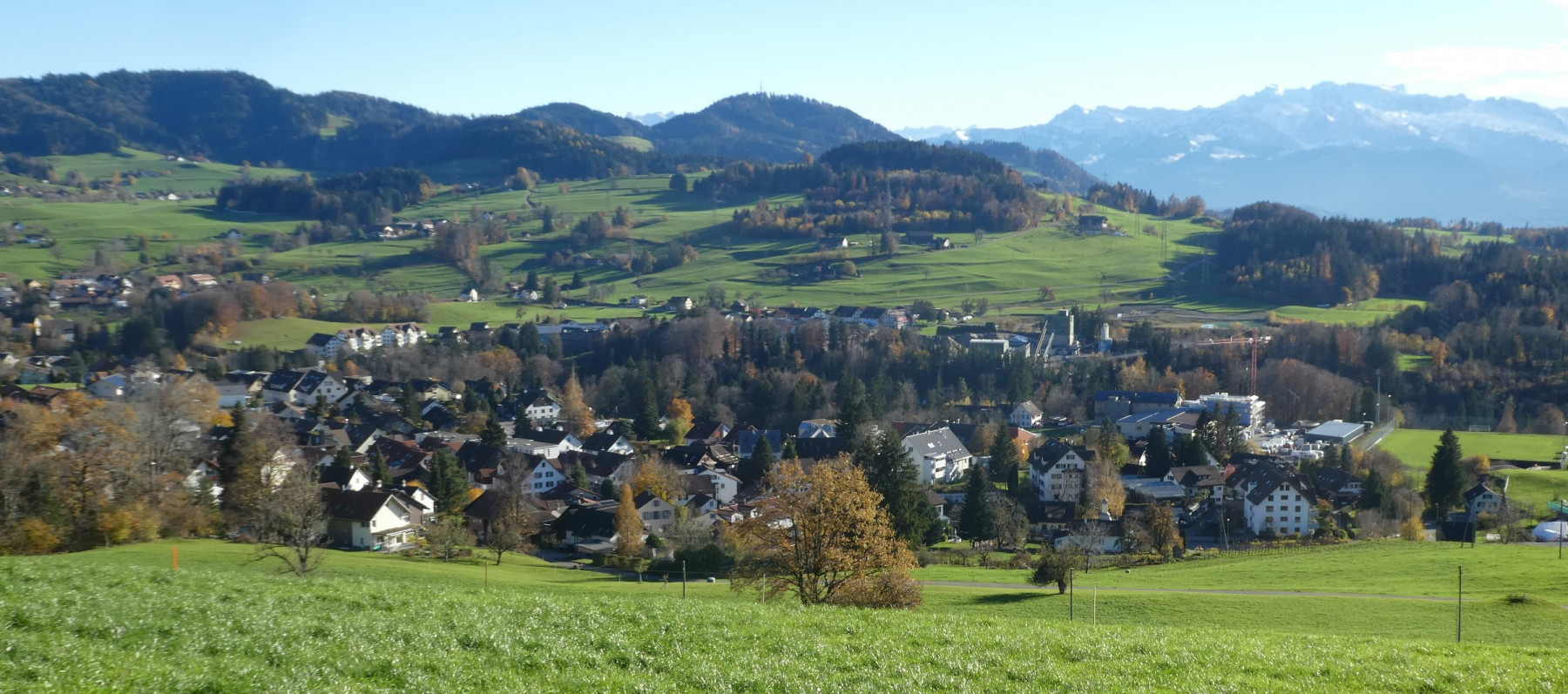
1: Distanz(0) - Blick vom Chilenbüel auf Adetswil. Dahinter Aabach-Tobel und Schürli / Kiesgrube
2: Distanz(0) - Blick vom Chilenbüel auf Adetswil. Rechts Fabrik «im Tobel», dahinter Aabach-Tobel und Schürli mit Kieswerk
3: Distanz(94) - Blick vom Leenacher auf Adetswil / Bäretswil. Dahinter Allmen
4: Distanz(94) - Vorne Meierhof und Schulhaus Adetswil, dahinter Aemet und Dorf Bäretswil
5: Distanz(98) - Standort der Rappoldskirche? 9.-14. Jh.?
6: Distanz(107) - Rosinli, Blick auf Bachtel, Zürichsee und Alpen
7: Distanz(107) - Rosinli, Blick auf Bachtel, Zürichsee und Alpen
8: Distanz(115) - Gesamtansicht vom Rosinli aus
9: Distanz(144) - Adetswil & Bäretswil vom Rosinli aus
10: Distanz(144) - Postkarte. Adetswil und Bachtel
11: Distanz(181) - Blick von der Kiesgrube Rtg Dorf
12: Distanz(182) - Weg hinunter zum Chatzetöbeli
13: Distanz(185) - Blick von der Rosinlikiesgrube Rtg Adetswil-Aemet
14: Distanz(189) - Kiesgrube. Blick Ritg. Adetswil - Aemet
15: Distanz(195) - Vom Ebnerberg zum Rosinli
16: Distanz(196) - Restaurant Rosinli
17: Distanz(201) - Rosinli 827m
18: Distanz(201) - Blick v. Rosinli auf Glarneralpen - Zürichse
19: Distanz(203) - Rosinli Rutschbahn
20: Distanz(207) - Adetswil, Bäretswil von der Rosinlistr. aus
Achtung: Ältere Karten können grössere Abweichungen zur aktuellen Landesvermessung aufweisen!